THE PROJECT
The proposed Bungaroo South Project consists of port facilities at Cape Preston and an iron ore mine at Bungaroo South, linked by a 200 km haul route. The open pits at Bungaroo South will mine channel iron deposits (CID) over a 15-year mine life. The proposed haul route crosses several major waterways including the Robe River.
PSM was engaged to prepare a flood study of the Robe River Crossing of the Bungaroo South haul road.
ENGINEERING AND TECHNICAL OPPORTUNITIES
The project required working with a sparse monitoring network coupled with extreme flood estimation uncertainty. There were also braided channel and multiple low-flow crossing points and a wide floodplain with overall crossing length over 1 km.
APPROACH AND INNOVATION
Following rigorous assessment and modelling, PSM’s tailored approach included:
- Estimation of uncertainty and error using multiple peak-flow estimation methods
- Development of a design strategy that focused on minimising capital costs and managing operational expenditure for a short mine life and low tonnage
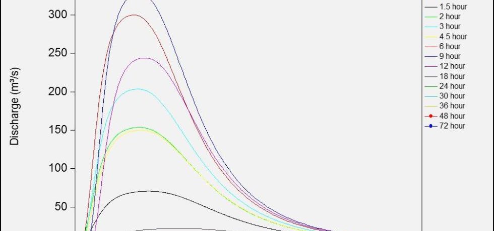
- Preparation of estimates of the two-year and 100-year floods to demonstrate the susceptibility of the road to higher magnitude flood events
- Preparation of 2D model based on LiDAR data to enable precise definition of flow paths
- Estimation of flood depths estands and velocities for a range of flood magnitudes using a TUFLOW GPU model
- Completion of parallel processing using a GPU reduced model runtimes allowing for an appropriate domain size and running of additional scenarios.
OUTCOMES
Rainfall-runoff modelling and regional methods (from Australian Rainfall and Runoff) improved the client’s confidence in estimating peak flows. An understanding of the hydraulic behaviour of the waterway crossing provided valuable information to the client for ongoing maintenance and repair of the road.


