THE PROJECT
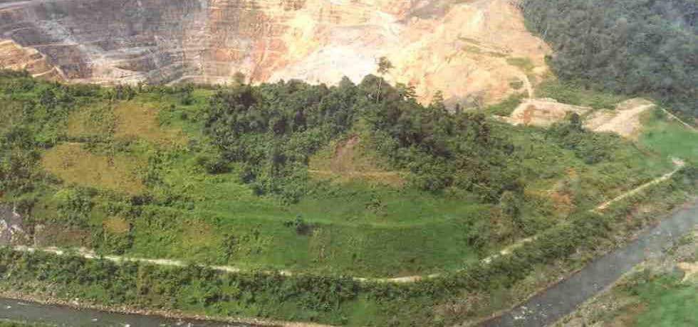
The Kelian River diversion, at the Kelian Equatorial Gold Mine, in East Kalimantan, Indonesia was constructed to redirect the Kelian River to the north of the open pit. Following the successful diversion and construction of an embankment across the diverted section of the river, the open pit was eventually excavated some 300 m below the invert level of the Kelian River level at rates of up to 30 million tonnes per year.
PSM was engaged to undertake the pre-feasibility hydrological assessment and hydraulic design. PSM was also responsible for geotechnical design of the cutting and ongoing monitoring and management of slope stability during construction and operation.
ENGINEERING AND TECHNICAL OPPORTUNITIES
The project integrated hydrological and geotechnical design of a river diversion in a remote region of Borneo, 2 km south of the equator. There were difficult geological conditions that comprised diatreme breccia (muddy breccia) and rhyolite intrusives in the basement carbonaceous sedimentary sequence, all with different geological controls on slope stability conditions.
Technical and engineering opportunities included:
- Diversion cuts of up to 80 m high in diatreme breccia (muddy breccia) and rhyolite intrusives in the basement carbonaceous sedimentary sequence
- Equatorial rainfall conditions resulting in high, fast flows in the Kelian River together with sediment loads of PMF = 3300 cumecs, Velocity > 5 m/s and rip rap 1.5 to 2 m d50
APPROACH AND INNOVATION
Following preparation of a geological model, PSM’s tailored approach included:
- Detailed geotechnical investigation of site (including geotechnical mapping, drilling, seismic refraction surveys including downhole to surface)
- Hydrological modelling of the Kelian River flows to assess dam burst flood conditions and assessment of flood heights to determine infrastructure founding levels
- Preparation of a landslide assessment to investigate the implications of ‘damming’ the river diversion
- Completion of a dam burst study to assess the impacts on downstream villages following a sudden release of water in steeply incised river course.
OUTCOMES
PSM’s construction surveillance, monitoring and mapping demonstrated that the geotechnical model was in agreement with the encountered conditions.
Services: #Geological #Hydrological #Indonesia #Open pit #River


